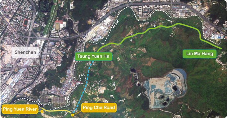
Welcome to the website of the Project “Widening of the Western Section and Eastern Section of Lin Ma Hang Road (Ping Yuen River to Ping Che Road / Tsung Yuen Ha to Lin Ma Hang)” - Design Study.
Most sections of Lin Ma Hang Road between Man Kam To Road and Lin Ma Hang have been excised from the Frontier Closed Area (FCA) since the implementation of the last stage of FCA reduction on 4 January 2016. The Government has engaged a consultant to study the widening of Lin Ma Hang Road Western Section (from Ping Yuen River to Ping Che Road) and Eastern Section (from Tsung Yuen Ha to Lin Ma Hang) to cater for the anticipated traffic growth of Lin Ma Hang Road due to the opening of the FCA, and to provide a safer and more efficient road network for local villagers and visitors.


Western Section
(Ping Yuen River to
Ping Che Road)

Eastern Section
(Tsung Yuen Ha to
Lin Ma Hang)

Ping Che Road to
Tsung Yuen Ha Section
(undertaken by CEDD's
Liantang / Heung Yuen Wai
Boundary Control Point
Project)


